Environmental Protection Industry MR-FAT Fourier Transform Infrared Telemeter Brand, Ranking

MR-FAT UAV Fourier transform infrared telemetry imager is a scanning gas infrared remote sensing telemetry instrument based on passive Fourier transform infrared spectroscopy technology, which can automatically detect and alarm target gas clouds, and can identify gases. Types and semi-quantitative gas concentrations. And mounting this instrument on a drone will make it more maneuverable.

Infrared spectrum is also called molecular fingerprint, and the infrared spectrum characteristics of different gas molecules are different. Most toxic and harmful gases have characteristic peaks in the long-wave infrared band. Fourier transform infrared spectroscopy technology uses the infrared spectral characteristics of gases for detection and analysis.

Product Description

Main Features

  • Equipped with DJI M300 drone, it can flexibly avoid obstacles and perform high-altitude detection and scanning.
  • Automatic and real-time analysis and identification of various gases, up to hundreds of gas types.
  • Long-distance, non-contact safety monitoring.
  • High spectral collection rate (20 times/second) and high spectral resolution (better than 2cm-1) to prevent false alarms.
  • First-person perspective scanning and identification of dangerous areas using DJI drone’s integrated camera.
  • IP66 protection grade, ensuring reliable operation in wind and rain.
  • Small size, light weight, and quick deployment for high maneuverability.
  • Multi-language visual interface with intelligent recognition and customizable options.

Application Areas

  • Fire rescue emergency monitoring
  • Monitoring of hazardous chemical emergencies
  • Public security emergency monitoring of hazardous chemicals

Technical Indicators

Measurable Gas Petrochemical: Methanol, ethanol, acetic acid, aniline, styrene, etc.
Fire Protection: AC, acetone, CS2, nitric acid, hydrazine, benzene, etc.
Other Chemicals: Hydrazine, AsH3, H2S, NF3, HCL, SO2, etc.
Military Poison Gases: VX, GA, GD, Soman, sarin, mustard gas, etc.
Detector Type Cooled mercury cadmium telluride detector
Detection Distance More than 4km
Spectral Range 8~12μm
Spectral Resolution Better than 2cm-1
Spectral Acquisition Rate 20 spectra/second (Δσ≤ 2 cm-1, double-sided interference pattern)
FPV Camera 960P
Operating Temperature -20℃ ~ +50℃
Protection Level Detector IP66, Drone protection level IP45
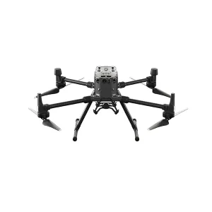
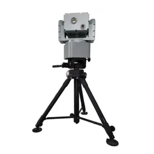
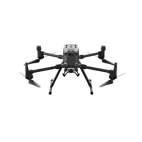
Installation Method Suspension mounted below M300RTK
Dimensions Expanded: 810×670×430 mm (L×W×H)
Folded: 430×420×430 mm (L×W×H)
Weight 12.8Kg (including dual batteries)

PC Software & Configuration

Software Features

  • Real-time image transmission of drone perspective images (supports user-customized interface).
  • 4G wireless transmission between the drone and the portable computer.
  • Efficient timing design with strong anti-interference characteristics.

Standard Configuration

  • Telemeter host
  • Portable laptop
  • Real-time identification software
  • DJI M300RTK (optional)
  • Carrying case
  • Operating Instructions & Certificate

Scenario Application

Gas detection drone application
Drone monitoring system

Frequently Asked Questions

Q1: How many types of gases can the system identify?

The system is capable of automatic, real-time analysis and identification of up to hundreds of different gas types across petrochemical, fire protection, and industrial chemical sectors.

Q2: What is the maximum effective detection range?

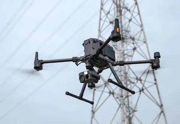
The system provides long-distance, non-contact safety monitoring with a detection distance exceeding 4 kilometers.

Q3: Is the equipment suitable for use in harsh weather conditions?

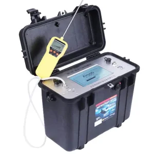
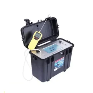
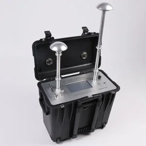
Yes, the detector has a protection grade of IP66, making it resistant to wind and rain, ensuring reliable operation in various environmental conditions.

Q4: Which drone platform is used for this monitoring system?

The system is specifically designed to be suspension-mounted below the DJI M300RTK drone for optimal stability and maneuverability.

Q5: How does the system prevent false alarms?

By maintaining a high spectral collection rate of 20 times per second and a spectral resolution better than 2cm-1, the system ensures high-precision data analysis to minimize false positives.

Q6: How is the data transmitted to the ground station?

The system utilizes 4G wireless transmission between the drone and the portable laptop, ensuring real-time image and data feedback.

Related Products